March 2025 Data Releases
OpenTopography provides easy, centralized access to a diverse collection of topographic data. We strive to simplify data discovery by providing a single, accessible platform that integrates data from academic, private, and federal sources, including the USGS 3D Elevation Program (3DEP) and NOAA Coastal Lidar. Below are highlights of datasets that became available on the OpenTopography platform in March 2025.
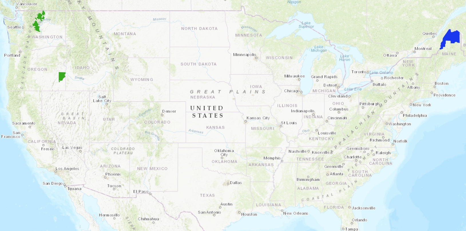
Location of USGS 3DEP and NOAA Coastal Lidar point cloud datasets released in March 2025 and accessible through OpenTopography. USGS 3DEP datasets are in green, NOAA Coastal Lidar data is in blue.
USGS 3D Elevation Program (3DEP) Datasets
The USGS is currently making 3DEP lidar point cloud data available via an Amazon Web Services (AWS) S3 Requester Pays Bucket, and as an AWS Public Dataset. To learn more about 3DEP and AWS see this USGS press release: USGS 3DEP Lidar Point Cloud Now Available as Amazon Public Dataset. Consistent with OpenTopography's mission of making high resolution topography data easier to discover and use, we provide a layer of value-added services that enable our users to subset, grid, download, and/or visualize any portion of the USGS 3DEP collection.
USGS 3DEP data is freely available to our core US academic user community (e.g. users who register with a .edu email domain). However, non-academics can access 3DEP data, as well as all other restricted datasets, by signing up for OpenTopography Plus (OT+). OT+ is a subscription service that enables one-stop, easy-to-use access to the highest quality lidar topography for the US. For more details about OT+, or to sign up, see the OT+ signup page.
New USGS 3DEP Datasets:
NOAA Coastal Lidar Datasets
The NOAA Coastal Lidar Data is a collection of lidar projects from many different sources and agencies, geographically focused on the coastal areas of the United States of America. The data are stored in the Entwine Point Tile format,and hosted on Amazon as part of the AWS Public Dataset Program. Consistent with OpenTopography's mission of making high resolution topography data easier to discover and use, we provide a layer of value-added services that enable our users to subset, grid, download, and/or visualize any portion of the NOAA Coastal Lidar collection.
NOAA Digital Coast data is freely available to our core US academic user community (e.g. users who register with a .edu email domain). However, non-academics can access NOAA data, as well as all other restricted datasets, by signing up for OpenTopography Plus (OT+). OT+ is a subscription service that enables one-stop, easy-to-use access to the highest quality lidar topography for the US. For more details about OT+, or to sign up, see the OT+ signup page.
New NOAA Coastal Lidar data:
OpenTopography Hosted Dataset: Canadian Moderate Resolution DTM and DSM
In March 2025, OpenTopography added access to the Canadian Moderate Resolution DTM and DSM. These products provide complete, 30 meter resolution, nationwide coverage for Canada. The spatial coverage extends into the USA, where needed, to provide coverage for cross-border watersheds in support of hydrological studies and applications. The data are freely available via the OpenTopography Portal in our Global & Regional DEMs collection as well as via our Global Datasets API.
New OpenTopography hosted data:
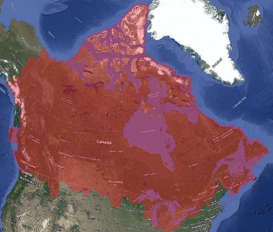
Spatial coverage of the Canadian Moderate Resolution DEM in transparent red overlaid on Google Earth Imagery.
Sample Graphics From Data Released in March 2025
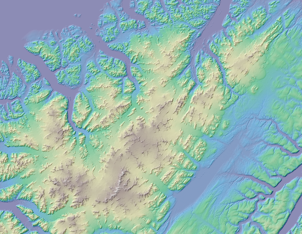
Colorized hillshade of Ellesmere Island from the 30m Canadian Moderate Resolution Digital Terrain Model. Data Source: OpenTopography: Medium Resolution Digital Elevation Model of Canada.
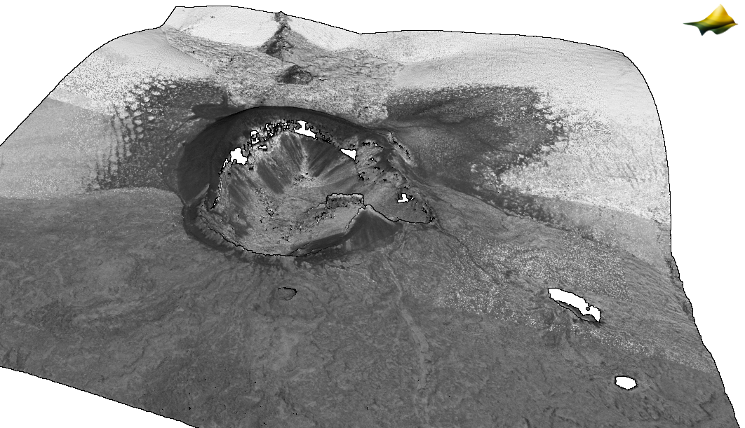
Point cloud colored by intensity of Coffee Pot Crater in the Jordan Craters volcanic field in Oregon. Data Source: USGS 3DEP: OR SouthEast 3 D22
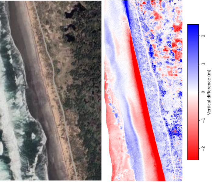
A section of coastline in Washington near Westport Light State Park. OpenTopography differencing tools were used to calculate the topographic change between 1997 and 2020. The differencing plot on the right shows large sections of beach erosion during this time frame. NOAA: 2020 USACE NCMP Topobathy Lidar: Washington
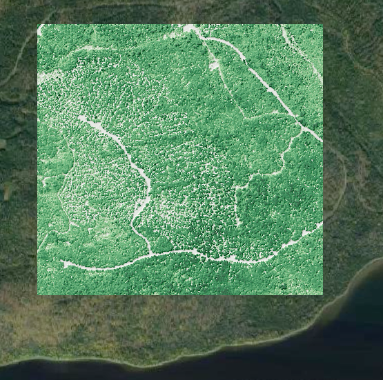
A canopy height model (CHM) near Eagle Lake, Maine. Darker greens indicate taller trees. This CHM is overlaid on Google Earth imagery. Data Source: NOAA: 2018 - 2019 State of Maine Lidar: Crown of Maine